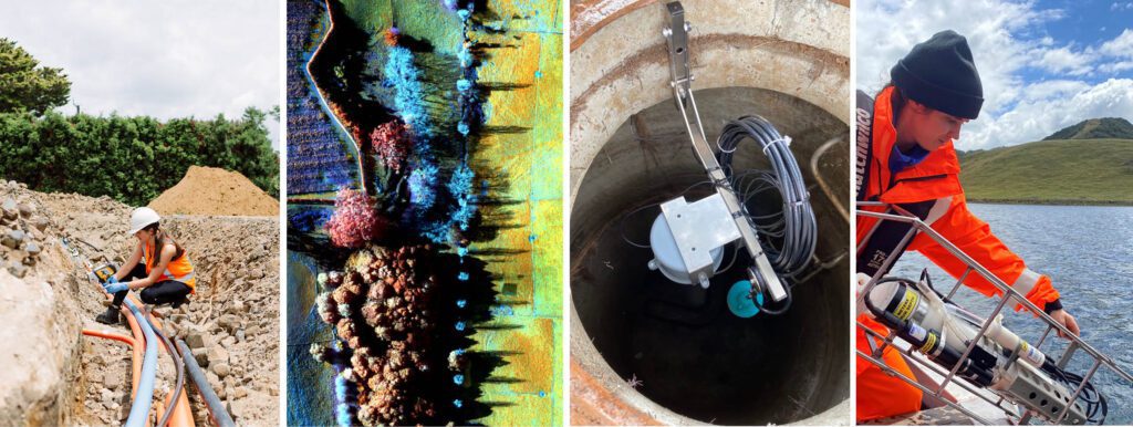
Water is currently a hot topic across all three sectors (potable water, wastewater and stormwater), with a focus on how we can manage water use and infrastructure requirements responsibly now and into the future.
We also need to give consideration to water quality and quantity, across lakes, rivers and groundwater, as these change with climate change and resource use.
Regardless of which side of the fence you sit on debating the Government’s Three Waters Reform Programme and proposed changes to the Resource Management Act, it is acknowledged that important and immediate steps need to be taken to better manage these precious water resources. The alternative is not an attractive picture – contamination, shortages, and unsustainable usage of precious wai; all of which impact the health and well-being of people and the environment, and back pockets too.
BTW have a team of multidisciplinary specialists focused on water issues. WAI EYE, Kanohi Hōmiromiro (an eye for detail), is a BTW programme and innovative approach to infrastructure assessment and leak detection using environmental engineers and scientists, and leading technology. It’s proven to be successful and was pioneered in Aotearoa by BTW in collaboration with Waipa District Council, and aligns with the vision statement of Te Mana o Te Wai.
WATER SUPPLY – LEAK DETECTION
BTW surveys pipelines, canals, and reservoirs to locate water leakage effectively and efficiently. This achieved using UAV-mounted thermal and multi-spectral sensors in combination with water pressure, flow, and physio-chemical analysis. This data is then packaged up into a simple online dashboard for asset managers to simply view and interact with. Long gone are the lengthy reports collecting dust and hiding data.
WASTEWATER – INFILTRATION AND INFLOW ASSESSMENT
Unnecessary water infiltration and inflow (I&I) into wastewater networks presents economic and environmental impacts. To identify and isolate I&I, BTW uses a portable array of level, flow, and rainfall sensors, combined with IoT telemetry to deliver and monitor data. Statistical algorithms are then used to prioritise problematic pipelines so that asset managers can make informed decisions.
STORMWATER – NETWORK SURVEY AND CALIBRATION
BTW complete targeted stormwater asset survey and monitoring, including the following items:
- Asset survey, including culvert, stormwater basin, gully, and pipe/manhole surveys
- LiDAR survey of large stormwater catchments
- Installation and monitoring of stormwater basin level sensors for model calibration and early warning alert systems
- Stormwater model verification surveys – including dwelling floor level capture
- Thermal Survey / Imaging, including water supply leak detection
WETLANDS – IDENTIFICATION AND DELINEATION
Often, referred to as the kidneys of the earth, wetlands play a critical role in water quality, provide habitat for native and endangered fauna and flora, maintenance of water flows and supply, and reduce flood and storm surge risk. BTW uses a multi-faceted approach combining remote sensing (multi-spectral, LiDAR, and high-resolution aerial imagery) and ‘boots on the ground’ environmental assessments to identify, delineate, and monitor wetlands to ensure that this valuable ecosystem is protected and restoration facilitated.

To find out more, speak with one of BTW’s WAI EYE team today.
Mathew Dickey on 0275 443 420
Dean Sandwell on 0273 784 529